
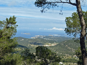
Sa Talaia
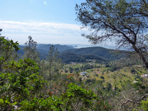
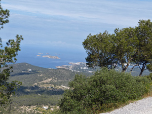
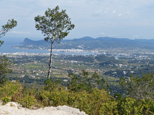
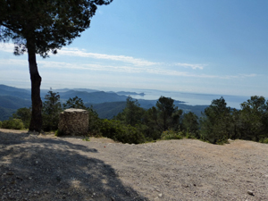
A walk to the summit of the highest peak on Ibiza. Views through the trees are better than expected and virtually all the climb is accomplished before the summit with an easy track walk for the return.
Spanish maps included within these descriptions are provided courtesy of the Spanish IGN and remain © Instituto Geográfico Nacional.
OSM (OpenStreetMap) and OCM (OpenCycleMap) maps are © OpenStreetMap Contributors. The OSM project welcomes contributions from all to enrich the map data, which is made freely available. Land (Thunderforest Landscape) maps are © Thunderforest based on data © OpenStreetMap contributors.
The grade of this walk is M/B, which means
M – Moderate: up to 12km in length, less than 400 metres ascent and less than 50% rough going.
B – Less than half the route on rough ground
| Nearest town | Sant Josep |
| Directions to start |
Follow the PM803 from Ibiza town to San Josep and soon afterwards turn L towards Cala Vedella. Go around the bend to the R and several hundred metres along this road find a minor concreted road on the LHS with space for one car a few metres up or alternatively a gravel layby on the RHS of the main road just a few metres beyond the junction with potential parking for 2/3 cars. (There is also limited parking near the roundabout 700m further W) |
| Start point (Lat/Long) | 38.921733, 1.280287 Click here to view in Google Maps (in a new browser tab) |
| Length (km) | 9.00 |
| Ascent (metres) | 340 |
| Walking time (hours) | 2.25 |
| Total time (hours) | 3 |
| Recommendations or Restrictions | Section of road walking at start is along very busy road – take care! |
Download walk descriptionDownload GPS file
Comments
Sa Talaia — No Comments
HTML tags allowed in your comment: <a href="" title=""> <abbr title=""> <acronym title=""> <b> <blockquote cite=""> <cite> <code> <del datetime=""> <em> <i> <q cite=""> <s> <strike> <strong>