
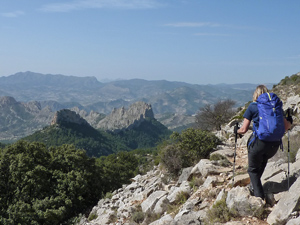
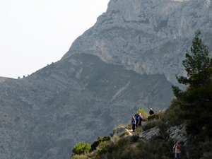
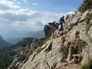
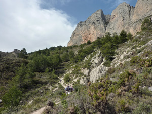
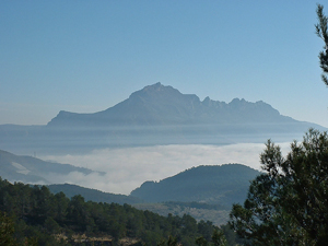
Sanchet Circuit from Rincon de Pepe
A 3km walk along pleasant paths to the start of the trail around Mt Sanchet (Sanxet). After the circuit return to car park by the same route. A spectacular walk along well defined and marked paths. A small amount of scrambling with some exposure.
Spanish maps included within these descriptions are provided courtesy of the Spanish IGN and remain © Instituto Geográfico Nacional.
OSM (OpenStreetMap) and OCM (OpenCycleMap) maps are © OpenStreetMap Contributors. The OSM project welcomes contributions from all to enrich the map data, which is made freely available. Land (Thunderforest Landscape) maps are © Thunderforest based on data © OpenStreetMap contributors.
The grade of this walk is S/B, which means
S – Strenuous: More than 600 metres ascent and/or more than 15km in length with steep, loose or heavily vegetated sections.
B – Less than half the route on rough ground.
| Nearest town | Guadalest |
| Directions to start |
Car park at restaurant “Rincon de Pepe” on North side of CV 70 very near km 35. |
| Start point (Lat/Long) | 38.654000, -0.177500 Click here to view in Google Maps (in a new browser tab) |
| Length (km) | 14.00 |
| Ascent (metres) | 680 |
| Walking time (hours) | 4.5 |
| Total time (hours) | 5.5 |
| Recommendations or Restrictions | None |
Download walk descriptionDownload GPS file

Comments
Sanchet Circuit from Rincon de Pepe — No Comments
HTML tags allowed in your comment: <a href="" title=""> <abbr title=""> <acronym title=""> <b> <blockquote cite=""> <cite> <code> <del datetime=""> <em> <i> <q cite=""> <s> <strike> <strong>