
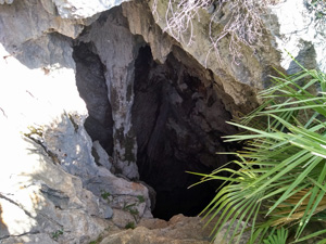
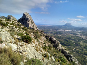
Segaria, Bolumini cave and Portet de Beniarbeig
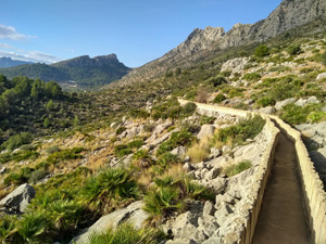
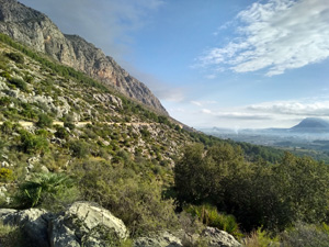
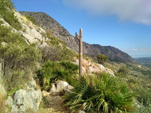
A route through the ridge with a little awkward terrain on the demanding Segaria massif with plenty of reward with features and scenery. Generally good going.
Spanish maps included within these descriptions are provided courtesy of the Spanish IGN and remain © Instituto Geográfico Nacional.
OSM (OpenStreetMap) and OCM (OpenCycleMap) maps are © OpenStreetMap Contributors. The OSM project welcomes contributions from all to enrich the map data, which is made freely available. Land (Thunderforest Landscape) maps are © Thunderforest based on data © OpenStreetMap contributors.
The grade of this walk is MS/C, which means
MS – Moderately Strenuous: Up to 600 metres ascent and/or no more than 15 km in length with some rough going taken at a reasonable pace.
C – More than half the route on rough ground.
| Nearest town | Beniarbeig |
| Directions to start |
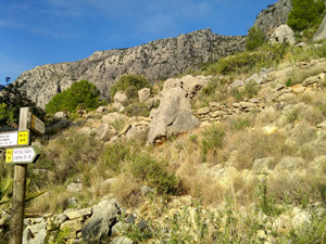
Driving N through the town of Ondara leave the town and at the second roundabout turn L towards Beniarbeig. 450m along this road look out for a R turn with obscure wooden finger post signed to the Zona Recreativa. Follow this under the motorway until you reach a T- jnc. Here turn R and a few metres along turn R uphill into the vast parking area for the Zona. |
| Start point (Lat/Long) | 38.833033, -0.009419 Click here to view in Google Maps (in a new browser tab) |
| Length (km) | 7.50 |
| Ascent (metres) | 445 |
| Walking time (hours) | 2.5 |
| Total time (hours) | 3.25 |
| Recommendations or Restrictions | Some tricky rock sections on the ascent where use of hands can be helpful. |
Download walk descriptionDownload GPS file
Comments
Segaria, Bolumini cave and Portet de Beniarbeig — No Comments
HTML tags allowed in your comment: <a href="" title=""> <abbr title=""> <acronym title=""> <b> <blockquote cite=""> <cite> <code> <del datetime=""> <em> <i> <q cite=""> <s> <strike> <strong>