
Serrella – Las Freginals,Alto de Tronca and Pla de Blancon
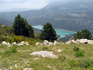
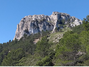
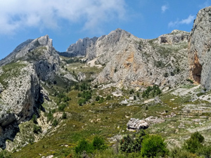
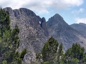
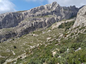
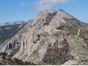
>A long steady,early ascent on marked paths, descend down the ‘ canal ‘ and across to a ruin overlooking Guadalest embalse, continue and pass a second ruin with well preserved ‘ era ‘,then spiral back down to Castells. Spectacular views and scenery throughout.
Spanish maps included within these descriptions are provided courtesy of the Spanish IGN and remain © Instituto Geográfico Nacional.
OSM (OpenStreetMap) and OCM (OpenCycleMap) maps are © OpenStreetMap Contributors. The OSM project welcomes contributions from all to enrich the map data, which is made freely available. Land (Thunderforest Landscape) maps are © Thunderforest based on data © OpenStreetMap contributors.
The grade of this walk is S/C, which means
S – Strenuous: More than 600 metres ascent and/or more than 15km in length with steep, loose or heavily vegetated sections.
C – More than half the route on rough ground.
| Nearest town | Castell de Castells |
| Directions to start |
Take the CV720 from Parcent and Benichembla to Castell de Castells. In the village, immediately opposite Hotel Serrella (on the RHS) turn L. After 20 m. turn L again into Calle Jose Antontio and then almost immediately L again down a ramp into the signed parking area. |
| Start point (Lat/Long) | 38.723848, -0.194761 Click here to view in Google Maps (in a new browser tab) |
| Length (km) | 12.00 |
| Ascent (metres) | 700 |
| Walking time (hours) | 3.66 |
| Total time (hours) | 4.66 |
| Recommendations or Restrictions | Although qualifying as a strenuous walk because of the 700m. Ascent the distance is only 12kms. So could be high end of an MS. |
Download walk descriptionDownload GPS file
3* due to the section from 6.5km to 8.8km – the path is VERY steep, VERY slippery, in quite a number of parts it doesn’t exist any more due to severe overgrowth/lack of use & there is a section where you have to fall/slide down a 35%+ shale slope for 50m+. which was very unpleasant.
5* for the views, particularly over Guadalest/Confrides.
Long trousers asbsolutely vital, along with VERY careful reading of the GPS track.
Moving time 4.5hrs, due to the great deal of path finding you have to do, as mentioned above.