
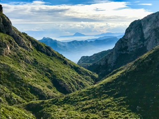
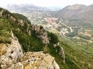
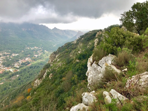
Cim De L’Aldaia Circuit
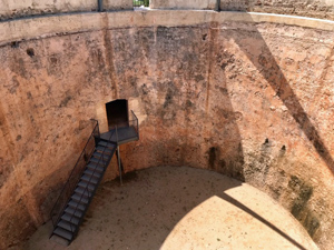
A varied route, which for the most part follows the PRCV-60. Taking in Fonts, a Hoyo, potholes, Neveretes, a summit with fine views and a Botanic micro reserve. After the initial flat valley track the route follows rugged mountain paths for the majority of the way, through a variety of Holly Oaks, Cork Oaks & other species.
Spanish maps included within these descriptions are provided courtesy of the Spanish IGN and remain © Instituto Geográfico Nacional.
OSM (OpenStreetMap) and OCM (OpenCycleMap) maps are © OpenStreetMap Contributors. The OSM project welcomes contributions from all to enrich the map data, which is made freely available. Land (Thunderforest Landscape) maps are © Thunderforest based on data © OpenStreetMap contributors.
The grade of this walk is MS/C, which means
MS – Moderately Strenuous: Up to 600 metres ascent and/or no more than 15 km in length with some rough going taken at a reasonable pace.
C – More than half the route on rough ground.
| Nearest town | Barx |
| Directions to start |
From Gandia on CV-675 at roundabout at eastern end of village with “BARX” sign on it. Take first exit onto Carrer Pep Andres Garba and turn right immediately and right again. Pass the Ajuntament De Barx office, then turn right into car park. Which is adjacent to the roundabout. |
| Start point (Lat/Long) | 39.011100, -0.299500 Click here to view in Google Maps (in a new browser tab) |
| Length (km) | 12.50 |
| Ascent (metres) | 443 |
| Walking time (hours) | 3.5 |
| Total time (hours) | 5.5 |
| Recommendations or Restrictions | Some parts will be muddy for a few days after rain. Be aware there are lots of hidden potholes and hoyos. |
Download walk descriptionDownload GPS file


Comments
Cim De L’Aldaia Circuit — No Comments
HTML tags allowed in your comment: <a href="" title=""> <abbr title=""> <acronym title=""> <b> <blockquote cite=""> <cite> <code> <del datetime=""> <em> <i> <q cite=""> <s> <strike> <strong>