
Simat to Cova de Patricio & Monastery Circuit.
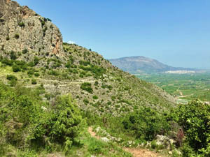
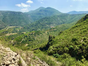
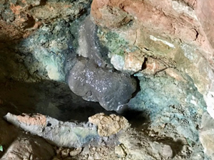
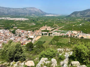
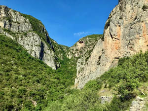
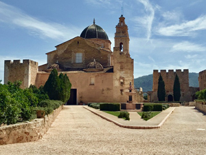
A country lane then paths lead via a steep climb to reach and cross barranco Fondo. An optional visit to a cave. A balcony pathway with fine views. Paths then wind down to the western end of the town. Passing through it via fonts and an optional (worthwhile) visit to the Monastery.
Spanish maps included within these descriptions are provided courtesy of the Spanish IGN and remain © Instituto Geográfico Nacional.
OSM (OpenStreetMap) and OCM (OpenCycleMap) maps are © OpenStreetMap Contributors. The OSM project welcomes contributions from all to enrich the map data, which is made freely available. Land (Thunderforest Landscape) maps are © Thunderforest based on data © OpenStreetMap contributors.
The grade of this walk is M/B, which means
M – Moderate: up to 12km in length, less than 400 metres ascent and less than 50% rough going.
B – Less than half the route on rough ground
| Nearest town | Simat de la Valldigna. |
| Directions to start |
From roundabout on CV-600 at edge of town turn L onto CV-675 bypass. At roundabout turn 2nd R towards Barx. Turn 1st R over bridge then immediately L onto C’ dels Brolls. Bear R to car park on L or park on street (Sat nav might send you through the town). |
| Start point (Lat/Long) | 39.041220, -0.308010 Click here to view in Google Maps (in a new browser tab) |
| Length (km) | 6.00 |
| Ascent (metres) | 320 |
| Walking time (hours) | 2.25 |
| Total time (hours) | 4 |
| Recommendations or Restrictions | None |
Download walk descriptionDownload GPS file
Comments
Simat to Cova de Patricio & Monastery Circuit. — No Comments
HTML tags allowed in your comment: <a href="" title=""> <abbr title=""> <acronym title=""> <b> <blockquote cite=""> <cite> <code> <del datetime=""> <em> <i> <q cite=""> <s> <strike> <strong>