
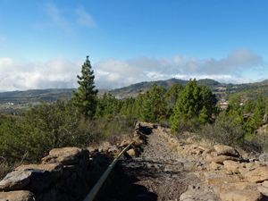
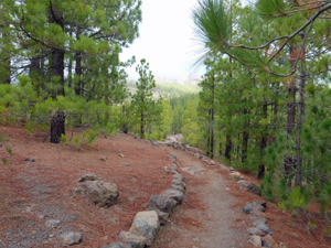
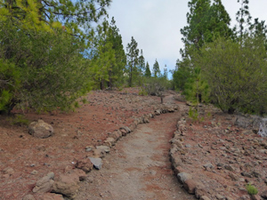
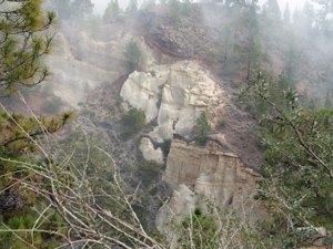
Teide from Sea to Summit – Vilaflor to the Parador – via Paisaje Lunar.
A lovely walk taking in some of the best of Tenerife’s scenery with views to the summit and sea and an interesting “lunar landscape”.
Spanish maps included within these descriptions are provided courtesy of the Spanish IGN and remain © Instituto Geográfico Nacional.
OSM (OpenStreetMap) and OCM (OpenCycleMap) maps are © OpenStreetMap Contributors. The OSM project welcomes contributions from all to enrich the map data, which is made freely available. Land (Thunderforest Landscape) maps are © Thunderforest based on data © OpenStreetMap contributors.
The grade of this walk is VS/B, which means
VS – Very Strenuous: More than 800 metres ascent and/or more than 20km in length with steep, loose or heavily vegetated sections.
B – Less than half the route on rough ground.
| Nearest town | Teide from Sea to Summit |
| Directions to start |
Take the TF21 road from Los Cristianos on the coast – signed to Teide and keep going until you reach the outskirts of Vilaflor. Pass the early parts of the village and turn R at snack bar La Paz. Drop down the hill about 300m to find a large car park on the RHS with a walled surround. |
| Start point (Lat/Long) | 28.160537, -16.636952 Click here to view in Google Maps (in a new browser tab) |
| Length (km) | 17.00 |
| Ascent (metres) | 1270 |
| Walking time (hours) | 5.00 |
| Total time (hours) | 7.00 |
| Recommendations or Restrictions | A very limited number of buses leave the Parador each day to return to the southern coast. |
Download walk descriptionDownload GPS file
Comments
Teide from Sea to Summit – Vilaflor to the Parador – via Paisaje Lunar. — No Comments
HTML tags allowed in your comment: <a href="" title=""> <abbr title=""> <acronym title=""> <b> <blockquote cite=""> <cite> <code> <del datetime=""> <em> <i> <q cite=""> <s> <strike> <strong>