
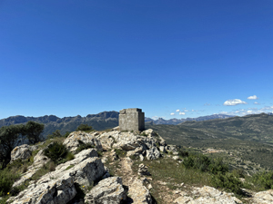
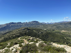
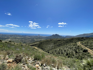
Tossalet del Castellet (El Cau) from Moli del Collao
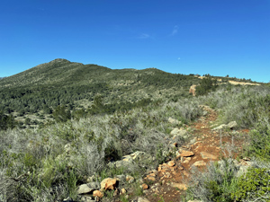
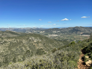
A steeper short-cut to the Cau ridge by-passing construction work then a pleasant wide ridge walk to the summit returning down the southern slopes of El Cau overlooking Calpe and Penyal de Ifac.
A short section of the descent uses chains.
Spanish maps included within these descriptions are provided courtesy of the Spanish IGN and remain © Instituto Geográfico Nacional.
OSM (OpenStreetMap) and OCM (OpenCycleMap) maps are © OpenStreetMap Contributors. The OSM project welcomes contributions from all to enrich the map data, which is made freely available. Land (Thunderforest Landscape) maps are © Thunderforest based on data © OpenStreetMap contributors.
The grade of this walk is MS/A, which means
MS – Moderately Strenuous: Up to 600 metres ascent and/or no more than 15 km in length with some rough going taken at a reasonable pace.
A – All on good tracks
| Nearest town | Jalon |
| Directions to start |
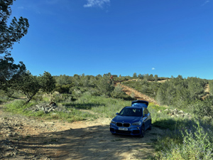
From Benissa towards Jalon on CV 750 turn Left into the Moli del Collao urbanisation follow Partida Collao to the end. Park on wasteland on LHS just past Casa Alba |
| Start point (Lat/Long) | 38.723380, 0.021660 Click here to view in Google Maps (in a new browser tab) |
| Length (km) | 9.00 |
| Ascent (metres) | 560 |
| Walking time (hours) | 4.5 |
| Total time (hours) | 5.5 |
| Recommendations or Restrictions | None |
Download walk descriptionDownload GPS file
Comments
Tossalet del Castellet (El Cau) from Moli del Collao — No Comments
HTML tags allowed in your comment: <a href="" title=""> <abbr title=""> <acronym title=""> <b> <blockquote cite=""> <cite> <code> <del datetime=""> <em> <i> <q cite=""> <s> <strike> <strong>