
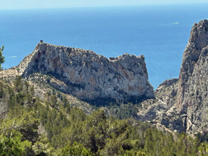
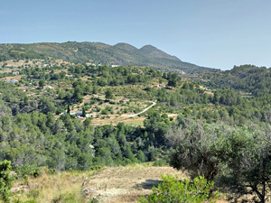
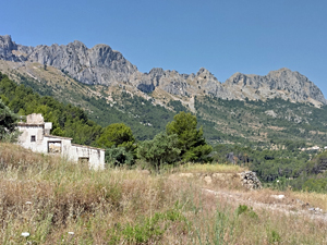
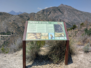
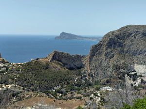
Vall del Estret
A challenging varied circular walk through the ‘ secret barranco ‘, with an interesting return around the flanks of Olta . Extensive views of mountains and coastline.
Spanish maps included within these descriptions are provided courtesy of the Spanish IGN and remain © Instituto Geográfico Nacional.
OSM (OpenStreetMap) and OCM (OpenCycleMap) maps are © OpenStreetMap Contributors. The OSM project welcomes contributions from all to enrich the map data, which is made freely available. Land (Thunderforest Landscape) maps are © Thunderforest based on data © OpenStreetMap contributors.
The grade of this walk is VS/C, which means
VS – Very Strenuous: More than 800 metres ascent and/or more than 20km in length with steep, loose or heavily vegetated sections.
C – More than half the route on rough ground.
| Nearest town | Calpe |
| Directions to start |
N332 south of Calpe Norte and Sur signs, km 166.6, look out for a wide surfaced road on right with bins- ample parking, but no left turn across N332 from Altea direction ! |
| Start point (Lat/Long) | 38.644026, 0.028274 Click here to view in Google Maps (in a new browser tab) |
| Length (km) | 20.80 |
| Ascent (metres) | 840 |
| Walking time (hours) | 6 |
| Total time (hours) | 7 |
| Recommendations or Restrictions | None |
Download walk descriptionDownload GPS file
Comments
Vall del Estret — No Comments
HTML tags allowed in your comment: <a href="" title=""> <abbr title=""> <acronym title=""> <b> <blockquote cite=""> <cite> <code> <del datetime=""> <em> <i> <q cite=""> <s> <strike> <strong>