
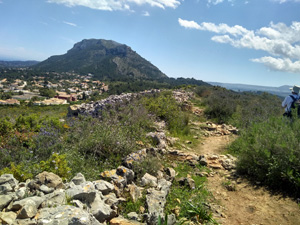
Iberian settlement via flank of Montgo
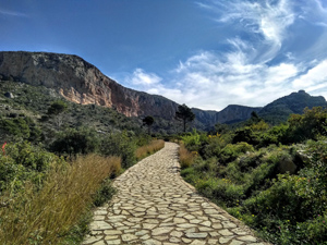
A walk through the woods followed by a steady ascent up a broad track. We then descend westerly to reach the Iberian settlement and return on the lower flank back to the cars.
Spanish maps included within these descriptions are provided courtesy of the Spanish IGN and remain © Instituto Geográfico Nacional.
OSM (OpenStreetMap) and OCM (OpenCycleMap) maps are © OpenStreetMap Contributors. The OSM project welcomes contributions from all to enrich the map data, which is made freely available. Land (Thunderforest Landscape) maps are © Thunderforest based on data © OpenStreetMap contributors.
The grade of this walk is M/B, which means
M – Moderate: up to 12km in length, less than 400 metres ascent and less than 50% rough going.
B – Less than half the route on rough ground
| Nearest town | Jesus Pobre |
| Directions to start |
Los Lagos. km 6 on CV735 between La Xara (near Denia) and Javea. Turn into Los Lagos, then immediately left and park. |
| Start point (Lat/Long) | 38.801992, 0.094628 Click here to view in Google Maps (in a new browser tab) |
| Length (km) | 9.00 |
| Ascent (metres) | 360 |
| Walking time (hours) | 3 |
| Total time (hours) | 4.5 |
| Recommendations or Restrictions | None |
Download walk descriptionDownload GPS file


Comments
Iberian settlement via flank of Montgo — No Comments
HTML tags allowed in your comment: <a href="" title=""> <abbr title=""> <acronym title=""> <b> <blockquote cite=""> <cite> <code> <del datetime=""> <em> <i> <q cite=""> <s> <strike> <strong>