
GR11 – Day 14. From Candanchu to Sallent de Gallego.
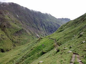
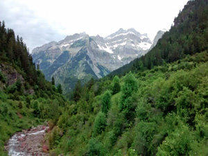
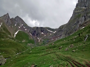
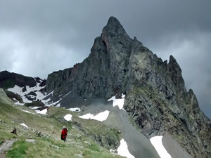
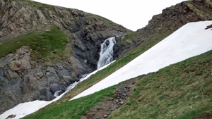
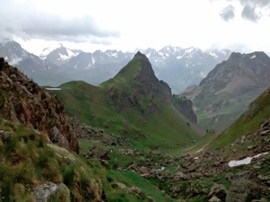
The initial stages are designed solely to connect you to the Canal Roya – a very attractive valley that gets more and more interesting as you ascend. From here the walk over the high pass and into the next valley is fantastic, but you end with a 7km road walk!
Spanish maps included within these descriptions are provided courtesy of the Spanish IGN and remain © Instituto Geográfico Nacional.
OSM (OpenStreetMap) and OCM (OpenCycleMap) maps are © OpenStreetMap Contributors. The OSM project welcomes contributions from all to enrich the map data, which is made freely available. Land (Thunderforest Landscape) maps are © Thunderforest based on data © OpenStreetMap contributors.
The grade of this walk is VS/A, which means
VS – Very Strenuous: More than 800 metres ascent and/or more than 20km in length with steep, loose or heavily vegetated sections.
A – All on good tracks
| Nearest town | Candanchu |
| Directions to start |
From Jaca on the E7 continue N on the N330 for 29km to reach the village of Candanchu |
| Start point (Lat/Long) | 42.788270, -0.527041 Click here to view in Google Maps (in a new browser tab) |
| Length (km) | 26.00 |
| Ascent (metres) | 1050 |
| Walking time (hours) | 7.00 |
| Total time (hours) | 8.50 |
| Recommendations or Restrictions | None |
Download walk descriptionDownload GPS file
Comments
GR11 – Day 14. From Candanchu to Sallent de Gallego. — No Comments
HTML tags allowed in your comment: <a href="" title=""> <abbr title=""> <acronym title=""> <b> <blockquote cite=""> <cite> <code> <del datetime=""> <em> <i> <q cite=""> <s> <strike> <strong>