
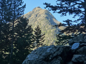
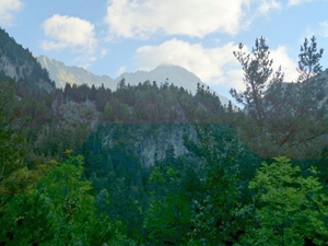
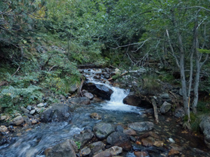
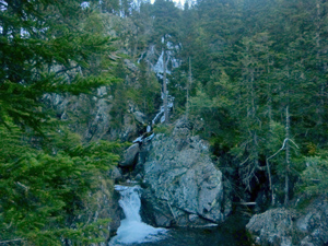
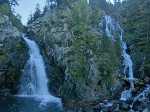
Alba waterfalls
A short but demanding walk to the waterfalls of the Alba – one of which is 50m high.
Can be connected to the Banos de Benasque walk.
Spanish maps included within these descriptions are provided courtesy of the Spanish IGN and remain © Instituto Geográfico Nacional.
OSM (OpenStreetMap) and OCM (OpenCycleMap) maps are © OpenStreetMap Contributors. The OSM project welcomes contributions from all to enrich the map data, which is made freely available. Land (Thunderforest Landscape) maps are © Thunderforest based on data © OpenStreetMap contributors.
The grade of this walk is E/B, which means
E – Easy: A walk of up to 4½ hours on good surfaced tracks and less than 200 metres ascent.
B – Less than half the route on rough ground
| Nearest town | Benasque |
| Directions to start |
Drive up the A139 to the N of Benasque and after passing the reservoir and the last of the road tunnels take a R turn signed to Banos de Benasque. Drop down the hill to park either just before or after the small hotel on the LHS. |
| Start point (Lat/Long) | 42.667655, 0.582050 Click here to view in Google Maps (in a new browser tab) |
| Length (km) | 2.50 |
| Ascent (metres) | 140 |
| Walking time (hours) | 1 |
| Total time (hours) | 1.5 |
| Recommendations or Restrictions | A more rugged expedition that the stats would suggest. If you are looking for something longer it is straightforward to connect this walk up to the Banos de Benasque route by following the Botanical trail where you meet it and then turning R on the track. |
Download walk descriptionDownload GPS file
Comments
Alba waterfalls — No Comments
HTML tags allowed in your comment: <a href="" title=""> <abbr title=""> <acronym title=""> <b> <blockquote cite=""> <cite> <code> <del datetime=""> <em> <i> <q cite=""> <s> <strike> <strong>