
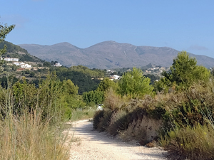
Calpe Countryside Circuit
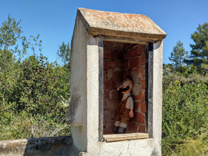
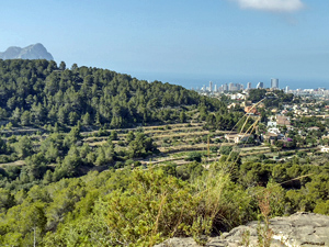
At the top end of the M/S grade due to the distance ,this new route starts at Calpe Tennis Club and takes us up to the Ermita de San Juan. From there it then follows part of the Pedros Paseo route to the Quisi watermill before returning to Calpe via a new route. Varied tracks and great views to both the coast and the mountains.
Spanish maps included within these descriptions are provided courtesy of the Spanish IGN and remain © Instituto Geográfico Nacional.
OSM (OpenStreetMap) and OCM (OpenCycleMap) maps are © OpenStreetMap Contributors. The OSM project welcomes contributions from all to enrich the map data, which is made freely available. Land (Thunderforest Landscape) maps are © Thunderforest based on data © OpenStreetMap contributors.
The grade of this walk is MS/B, which means
MS – Moderately Strenuous: Up to 600 metres ascent and/or no more than 15 km in length with some rough going taken at a reasonable pace.
B – Less than half the route on rough ground
| Nearest town | Calpe |
| Directions to start |
Calpe tennis club (coming into Calpe from the N332, turn left at the Mas y Mas Centro Comercial roundabout and park by the tennis club or opposite). |
| Start point (Lat/Long) | 38.648100, 0.050090 Click here to view in Google Maps (in a new browser tab) |
| Length (km) | 16.00 |
| Ascent (metres) | 340 |
| Walking time (hours) | 5 |
| Total time (hours) | 6 |
| Recommendations or Restrictions |
Download walk descriptionDownload GPS file
Comments
Calpe Countryside Circuit — No Comments
HTML tags allowed in your comment: <a href="" title=""> <abbr title=""> <acronym title=""> <b> <blockquote cite=""> <cite> <code> <del datetime=""> <em> <i> <q cite=""> <s> <strike> <strong>