
Castell Granadella Circuit
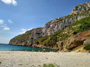
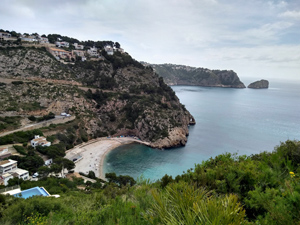
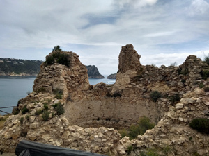
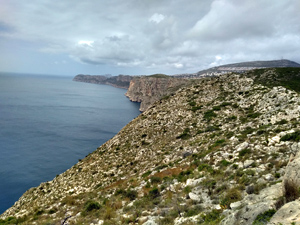
Costal walk with interesting ups and downs with beach visit and visit to ruins of costal defence castle.
Spanish maps included within these descriptions are provided courtesy of the Spanish IGN and remain © Instituto Geográfico Nacional.
OSM (OpenStreetMap) and OCM (OpenCycleMap) maps are © OpenStreetMap Contributors. The OSM project welcomes contributions from all to enrich the map data, which is made freely available. Land (Thunderforest Landscape) maps are © Thunderforest based on data © OpenStreetMap contributors.
The grade of this walk is M/C, which means
M – Moderate: up to 12km in length, less than 400 metres ascent and less than 50% rough going.
C – More than half the route on rough ground
| Nearest town | Benitatxell |
| Directions to start |
From the N332 (between kilometre 181 and 182) take the CV740 to Teulada. Go straight ahead at the 1st roundabout. At the 2nd roundabout exit left towards the roundabout with the metal fish. At this roundabout go straight ahead and take the duel carriageway through Teulada. At the end of the shopping area look carefully for the sharp turning off left which is the continuation of the CV740 to Benitatxell. Go through Benitatxell following signs to Javia. Just before leaving the town turn right to Cumbre Del Sol. Go up on this road and then follow signs to HIPICA BAR. Park where the road turns sharp left and an unpaved track goes straight ahead. The walk begins here. |
| Start point (Lat/Long) | 38.724392, 0.169730 Click here to view in Google Maps (in a new browser tab) |
| Length (km) | 8.50 |
| Ascent (metres) | 378 |
| Walking time (hours) | 2.50 |
| Total time (hours) | 3.5 |
| Recommendations or Restrictions | Very rocky going in places. Could possibly start the walk from the Cala Granadella although parking there is very limited. |
Download walk descriptionDownload GPS file
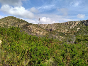
We did a variation of this route today,14 March 2017. In many places it has yet to recover from last September’s extensive fire. 100m from the start we headed North to the estate road that runs from Segunda Planar to the Granadella Mirador then across to the road down to the beach (path alongside the road in the trees). Then much as described. The fences on the path near the castle were all burnt and a couple of men were replacing these as we walked past. A very pleasant route which will improve once the fire damage is repaired by Nature. Thanks for posting the details.
The fencing from the castle towards the Granadella beach was all destroyed in the fire. I walked it when the fence was not there and felt it was safe for walkers. However I am commenting only to advise people that all the fencing has now been replaced.
Helen & I did this walk on 03/02/21. We found the directions easy to follow until we left the Mirador Levante, but it was then just a case of following the CV354 signs to Mirador Granadella (also marked with Y/W) which took us back to the car.
We did this on 15/04/2022. Excellent gps file and good instructions. This maybe our favourite walk in this area
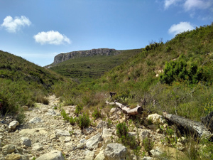
Thank you for publishing the guidance for this and other walks in the Costa Blanca. We did this walk yesterday, anti-clockwise as described. For the first time in Spain I downloaded the GPS file into my OS app and it worked perfectly. The white and yellow way markers have recently been repainted; they are so numerous and prominent that are almost intrusive, at least on the outward leg of the journey. The route description is highly accurate although the tracks on either side of the castle, although clear to follow, are more rocky and uneven that we had anticipated from the M/A grade, and good walking shoes or boots are essential. The flora is in the early stages of recovery from the extensive fires of a few years ago, although the valley descending to Granadella still looks a bit barren.
This is a really nice walk with beautiful views. You can have a nice break in a cafe at the beach and go for a swim in the middle of the tour. Meanwhile nature recovered from the fires and is quite diverse! Hiking boots are recommended. Thank you for posting this walk, we really enjoyed it and recommend it!