
Circuit from Castell de Castells on the flanks of Alfaro
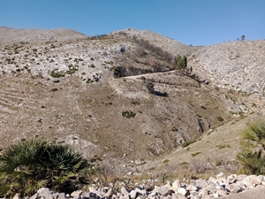
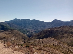
An easy way to walk up on the flanks of Alfaro for fantastic views of the Serrella range and the mountains nearer the coast. Paths, forest tracks and farm building access roads.
Spanish maps included within these descriptions are provided courtesy of the Spanish IGN and remain © Instituto Geográfico Nacional.
OSM (OpenStreetMap) and OCM (OpenCycleMap) maps are © OpenStreetMap Contributors. The OSM project welcomes contributions from all to enrich the map data, which is made freely available. Land (Thunderforest Landscape) maps are © Thunderforest based on data © OpenStreetMap contributors.
The grade of this walk is MS/A, which means
MS – Moderately Strenuous: Up to 600 metres ascent and/or no more than 15 km in length with some rough going taken at a reasonable pace.
A – All on good tracks
| Nearest town | Castell de Castells |
| Directions to start |
Approaching Castell de Castells on the CV720 immediately past the village sign double back to the R on a minor road. Follow this until you reach a fenced compound with bins on the RHS and a large building in front of you (the sheep farm) at a junction. Park on the L. |
| Start point (Lat/Long) | 38.730950, -0.201737 Click here to view in Google Maps (in a new browser tab) |
| Length (km) | 10.50 |
| Ascent (metres) | 460 |
| Walking time (hours) | 4 |
| Total time (hours) | 4.5 |
| Recommendations or Restrictions | None. Possibly better to do this route in reverse. Note – the gps track with this route is “constructed”. Currently there is no “as walked” track available and therefore no times for each segment. |
Download walk descriptionDownload GPS file
Comments
Circuit from Castell de Castells on the flanks of Alfaro — No Comments
HTML tags allowed in your comment: <a href="" title=""> <abbr title=""> <acronym title=""> <b> <blockquote cite=""> <cite> <code> <del datetime=""> <em> <i> <q cite=""> <s> <strike> <strong>