
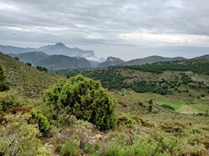
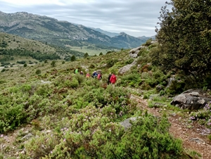
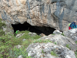
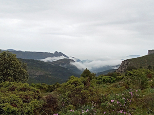
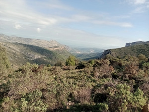
Cueva de Tossal del Vaquero and Cocoll airfield
An easy track ascent to the Cocoll airfield leads to a mountain path to visit a large rocky cave on the slopes of Tossal del Vaquero (es Crestall) before rejoining our outward track to descend to the cars.
Spanish maps included within these descriptions are provided courtesy of the Spanish IGN and remain © Instituto Geográfico Nacional.
OSM (OpenStreetMap) and OCM (OpenCycleMap) maps are © OpenStreetMap Contributors. The OSM project welcomes contributions from all to enrich the map data, which is made freely available. Land (Thunderforest Landscape) maps are © Thunderforest based on data © OpenStreetMap contributors.
The grade of this walk is MS/A, which means
MS – Moderately Strenuous: Up to 600 metres ascent and/or no more than 15 km in length with some rough going taken at a reasonable pace.
A – All on good tracks
| Nearest town | Castell de Castells |
| Directions to start |
The CV720 runs into the mountains from Pedreguer passing through Alcalali, Benichembla and arriving at Castell de Castells. Pass through the village and take the CV752 towards Tarbena uphill until you reach track parking on the RHS near KM7. |
| Start point (Lat/Long) | 38.715390, -0.160760 Click here to view in Google Maps (in a new browser tab) |
| Length (km) | 12.00 |
| Ascent (metres) | 420 |
| Walking time (hours) | 3.5 |
| Total time (hours) | 4.5 |
| Recommendations or Restrictions | None |
Download walk descriptionDownload GPS file
Comments
Cueva de Tossal del Vaquero and Cocoll airfield — No Comments
HTML tags allowed in your comment: <a href="" title=""> <abbr title=""> <acronym title=""> <b> <blockquote cite=""> <cite> <code> <del datetime=""> <em> <i> <q cite=""> <s> <strike> <strong>