
Fredes Circular
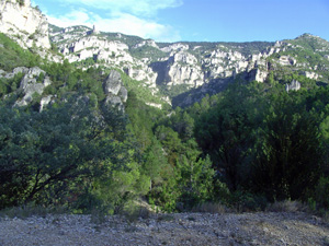
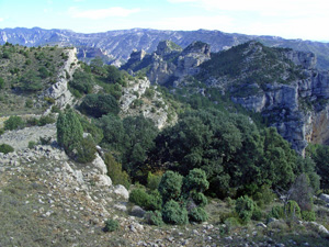
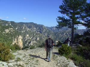
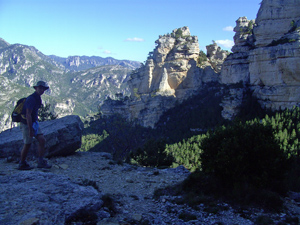
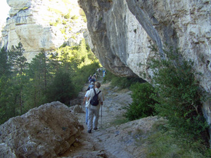
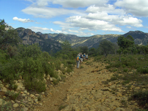
A delightful walk with stunning rock architecture emerging from the trees on the first half of the walk and a fantastic ridge view after lunch.
Spanish maps included within these descriptions are provided courtesy of the Spanish IGN and remain © Instituto Geográfico Nacional.
OSM (OpenStreetMap) and OCM (OpenCycleMap) maps are © OpenStreetMap Contributors. The OSM project welcomes contributions from all to enrich the map data, which is made freely available. Land (Thunderforest Landscape) maps are © Thunderforest based on data © OpenStreetMap contributors.
The grade of this walk is S/A, which means
S – Strenuous: More than 600 metres ascent and/or more than 15km in length with steep, loose or heavily vegetated sections.
A – All good tracks.
| Nearest town | La Senia |
| Directions to start |
From the town of La Senia follow the CV105 north out of the village and towards Benifassa. Follow this road for some 5.5km until after passing through 2 short tunnels you emerge on a reservoir dam. Cross this and take an immediate right turn onto a forest track. Follow this for some 1.7km until the first buildings start to appear and there is a side track going half left. There is parking here on rough ground with some tree cover. (Mangraner) |
| Start point (Lat/Long) | 40.686919, 0.222248 Click here to view in Google Maps (in a new browser tab) |
| Length (km) | 16.60 |
| Ascent (metres) | 787 |
| Walking time (hours) | 4.50 |
| Total time (hours) | 6.00 |
| Recommendations or Restrictions |
Download walk descriptionDownload GPS file
Comments
Fredes Circular — No Comments
HTML tags allowed in your comment: <a href="" title=""> <abbr title=""> <acronym title=""> <b> <blockquote cite=""> <cite> <code> <del datetime=""> <em> <i> <q cite=""> <s> <strike> <strong>