
Hospital de Vielha (Espitau) to Refugio Restanca
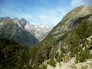
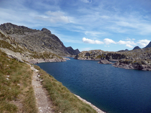
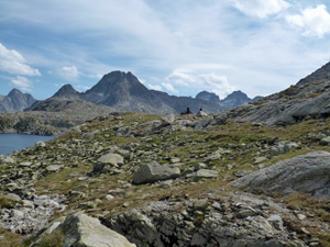
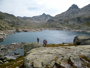
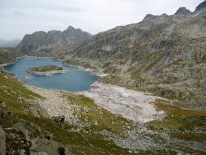
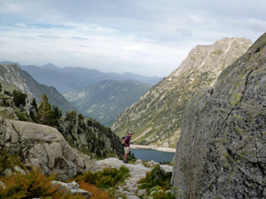
A fantastic adventure into the high mountains initially along the GR11 and then diverging to more challenging terrain alongside 2 lakes with a col between them.
Spanish maps included within these descriptions are provided courtesy of the Spanish IGN and remain © Instituto Geográfico Nacional.
OSM (OpenStreetMap) and OCM (OpenCycleMap) maps are © OpenStreetMap Contributors. The OSM project welcomes contributions from all to enrich the map data, which is made freely available. Land (Thunderforest Landscape) maps are © Thunderforest based on data © OpenStreetMap contributors.
The grade of this walk is VS/C, which means
VS – Very Strenuous: More than 800 metres ascent and/or more than 20km in length with steep, loose or heavily vegetated sections.
C – More than half the route on rough ground.
| Nearest town | Vielha |
| Directions to start |
Hospital de Vielha at the south end of the tunnel from Vielha on the N230. Park near the old hospital buildings accessed from the approach road to the OLD tunnel (indicated for dangerous loads). |
| Start point (Lat/Long) | 42.627500, 0.762900 Click here to view in Google Maps (in a new browser tab) |
| Length (km) | 14.00 |
| Ascent (metres) | 1075 |
| Walking time (hours) | 5.66 |
| Total time (hours) | 8.66 |
| Recommendations or Restrictions | For experienced mountaineers only. Requires overnight accommodation at the Refugio on completion. |
Download walk descriptionDownload GPS file
Comments
Hospital de Vielha (Espitau) to Refugio Restanca — No Comments
HTML tags allowed in your comment: <a href="" title=""> <abbr title=""> <acronym title=""> <b> <blockquote cite=""> <cite> <code> <del datetime=""> <em> <i> <q cite=""> <s> <strike> <strong>