
La Solana, Tossal Gran and Riu Xalo or Gorgos
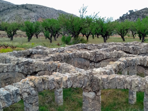
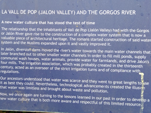
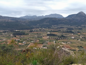
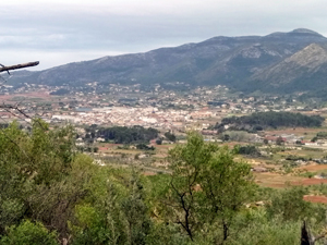
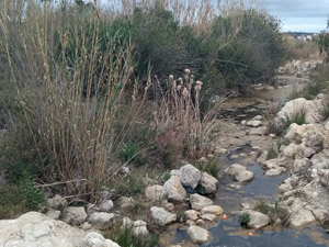
A circular route over varied terrain,with early steep ascent, two ridges,two short scrambles,a cave visit, extensive views through the Jalon valley and visit a well preserved Roman water feature alongside the Rio Xalo o de Gorgos.
Spanish maps included within these descriptions are provided courtesy of the Spanish IGN and remain © Instituto Geográfico Nacional.
OSM (OpenStreetMap) and OCM (OpenCycleMap) maps are © OpenStreetMap Contributors. The OSM project welcomes contributions from all to enrich the map data, which is made freely available. Land (Thunderforest Landscape) maps are © Thunderforest based on data © OpenStreetMap contributors.
The grade of this walk is S/B/Scr, which means
S – Strenuous: More than 600 metres ascent and/or more than 15km in length with steep, loose or heavily vegetated sections.
B – Less than half the route on rough ground.
Scr – Scrambling: This implies the need for handholds to ascend steep rock pitches with a sense of exposure to vertigo and where a slip could lead to a serious accident.
| Nearest town | Jalon |
| Directions to start |
Jalon, Rastro car park. Car park under trees opposite Alleluya Bar at Information Office. |
| Start point (Lat/Long) | 38.743931, -0.017188 Click here to view in Google Maps (in a new browser tab) |
| Length (km) | 14.00 |
| Ascent (metres) | 750 |
| Walking time (hours) | 4.25hr |
| Total time (hours) | 5.25hr |
| Recommendations or Restrictions | Some early steep ascent |
Download walk descriptionDownload GPS file
Loved the ridge, great fun but it’s fair to say that both the route up to the ridge and that down to the first col are very indistinct and overgrown – perhaps we will endeavor to take some loppers next time! Views from the ridge are just wonderful.