
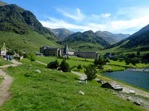
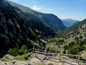
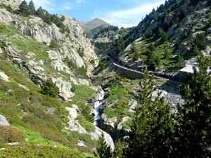
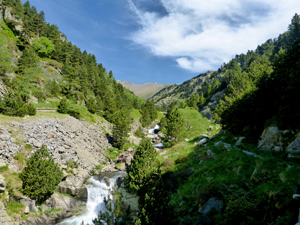
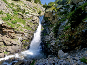
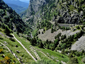
Nuria to Queralbs via Cami Vel
A wonderful walk down the Nuria gorge using the Cami Vel – the ancient path used to access the Santuario.
Spanish maps included within these descriptions are provided courtesy of the Spanish IGN and remain © Instituto Geográfico Nacional.
OSM (OpenStreetMap) and OCM (OpenCycleMap) maps are © OpenStreetMap Contributors. The OSM project welcomes contributions from all to enrich the map data, which is made freely available. Land (Thunderforest Landscape) maps are © Thunderforest based on data © OpenStreetMap contributors.
The grade of this walk is M/A, which means
M – Moderate: up to 12km in length, less than 400 metres ascent and less than 50% rough going.
A – All on good tracks
| Nearest town | Queralbs |
| Directions to start |
The start can only be reached by using the rack railway that starts in Ribes de Freser and stops at Queralbs where there is a large car park at the station. Cost in 2019 was €19.50 return. |
| Start point (Lat/Long) | 42.397541, 2.154548 Click here to view in Google Maps (in a new browser tab) |
| Length (km) | 9.00 |
| Ascent (metres) | 100 |
| Walking time (hours) | 2.66 |
| Total time (hours) | 4 |
| Recommendations or Restrictions | Can obviously also be done as an ascent. There is a “race” circuit for the climb and many people use this as a training run. It is generally a very busy route! |
Download walk descriptionDownload GPS file
Comments
Nuria to Queralbs via Cami Vel — No Comments
HTML tags allowed in your comment: <a href="" title=""> <abbr title=""> <acronym title=""> <b> <blockquote cite=""> <cite> <code> <del datetime=""> <em> <i> <q cite=""> <s> <strike> <strong>