
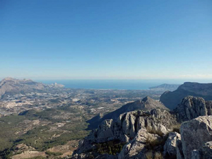
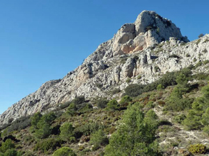
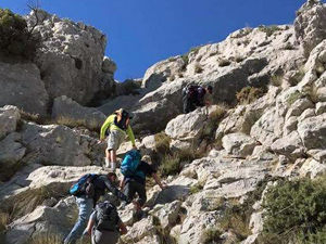
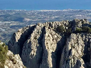
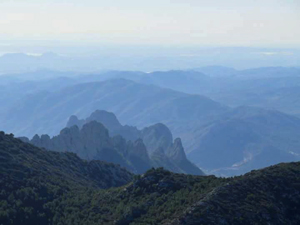
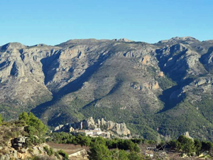
Penya Roc circuit and summit
Enjoy some good forestry paths before reaching ‘ the scramble ‘ up a magnificent peak – 360 deg.views rewards the exertion and a downhill return.
Spanish maps included within these descriptions are provided courtesy of the Spanish IGN and remain © Instituto Geográfico Nacional.
OSM (OpenStreetMap) and OCM (OpenCycleMap) maps are © OpenStreetMap Contributors. The OSM project welcomes contributions from all to enrich the map data, which is made freely available. Land (Thunderforest Landscape) maps are © Thunderforest based on data © OpenStreetMap contributors.
The grade of this walk is S/C/Scr/X, which means
S – Strenuous: More than 600 metres ascent and/or more than 15km in length with steep, loose or heavily vegetated sections.
C – More than half the route on rough ground.
Scr – Scrambling: This implies the need for handholds to ascend steep rock pitches with a sense of exposure to vertigo and where a slip could lead to a serious accident.
X – Experienced walkers route: the route requires considerable stamina and/or significant scrambling skills on rough, steep or exposed sections.
| Nearest town | Guadalest |
| Directions to start |
Follow the CV70 from Benidorm towards Guadalest. At km 33.5 look out for a L turn with generous signposting to Hostal Trestellador. Take this road and after a few hundred metres take a L turn doubling back. Follow round to a RH bend and with fence on LHS look for parking on a track on RHS. |
| Start point (Lat/Long) | 38.656510, -0.196810 Click here to view in Google Maps (in a new browser tab) |
| Length (km) | 14.00 |
| Ascent (metres) | 760 |
| Walking time (hours) | 4.5 |
| Total time (hours) | 5.33 |
| Recommendations or Restrictions | An ability for hand scrambling |
Download walk descriptionDownload GPS file
Comments
Penya Roc circuit and summit — No Comments
HTML tags allowed in your comment: <a href="" title=""> <abbr title=""> <acronym title=""> <b> <blockquote cite=""> <cite> <code> <del datetime=""> <em> <i> <q cite=""> <s> <strike> <strong>