
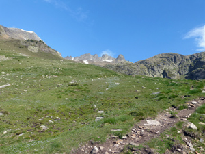
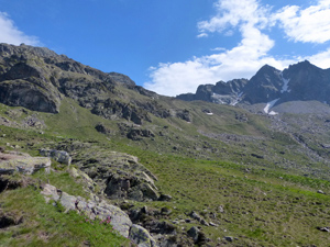
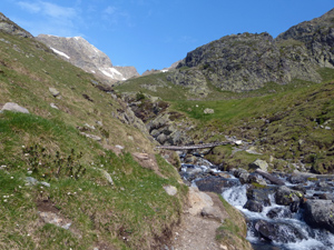
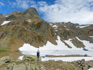
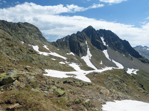
Puerto de la Glera
An arduous day exploring the slopes leading up to the French border. Harder than the stats suggest!
Spanish maps included within these descriptions are provided courtesy of the Spanish IGN and remain © Instituto Geográfico Nacional.
OSM (OpenStreetMap) and OCM (OpenCycleMap) maps are © OpenStreetMap Contributors. The OSM project welcomes contributions from all to enrich the map data, which is made freely available. Land (Thunderforest Landscape) maps are © Thunderforest based on data © OpenStreetMap contributors.
The grade of this walk is MS/B, which means
MS – Moderately Strenuous: Up to 600 metres ascent and/or no more than 15 km in length with some rough going taken at a reasonable pace.
B – Less than half the route on rough ground
| Nearest town | Benasque |
| Directions to start |
The N260 runs E-W along the central part of N Spain. From this find the A139 heading N to Benasque. Follow this road past Benasque for several kilometers to reach its unexpected end. Park here. |
| Start point (Lat/Long) | 42.684671, 0.604464 Click here to view in Google Maps (in a new browser tab) |
| Length (km) | 7.00 |
| Ascent (metres) | 540 |
| Walking time (hours) | 2.5 |
| Total time (hours) | 4.25 |
| Recommendations or Restrictions | The start (and finish) is very steep and involves mixed tree roots and boulders. |
Download walk descriptionDownload GPS file
Comments
Puerto de la Glera — No Comments
HTML tags allowed in your comment: <a href="" title=""> <abbr title=""> <acronym title=""> <b> <blockquote cite=""> <cite> <code> <del datetime=""> <em> <i> <q cite=""> <s> <strike> <strong>