
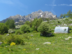
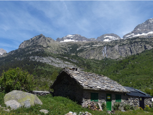
Cabana de Turmo from Puente de San Chaime
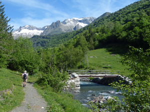
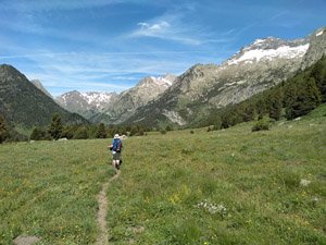
A delightful walk up this preserved valley with high pastures and panoramic views during the outgoing journey and an easy track descent in woodland to return.
Spanish maps included within these descriptions are provided courtesy of the Spanish IGN and remain © Instituto Geográfico Nacional.
OSM (OpenStreetMap) and OCM (OpenCycleMap) maps are © OpenStreetMap Contributors. The OSM project welcomes contributions from all to enrich the map data, which is made freely available. Land (Thunderforest Landscape) maps are © Thunderforest based on data © OpenStreetMap contributors.
The grade of this walk is S/B, which means
S – Strenuous: More than 600 metres ascent and/or more than 15km in length with steep, loose or heavily vegetated sections.
B – Less than half the route on rough ground.
| Nearest town | Benasque |
| Directions to start |
The N260 runs E-W along the central part of N Spain. From this find the A139 heading N to Benasque. Follow this road past Benasque for several kilometers to reach a sing indicating the Estos valley where you have to swing off to the L in order to cross the main road by turning L. Follow this a little way to reach the parking on the LHS. |
| Start point (Lat/Long) | 42.628982, 0.540509 Click here to view in Google Maps (in a new browser tab) |
| Length (km) | 14.00 |
| Ascent (metres) | 615 |
| Walking time (hours) | 4 |
| Total time (hours) | 5.25 |
| Recommendations or Restrictions | None |
Download walk descriptionDownload GPS file
Comments
Cabana de Turmo from Puente de San Chaime — No Comments
HTML tags allowed in your comment: <a href="" title=""> <abbr title=""> <acronym title=""> <b> <blockquote cite=""> <cite> <code> <del datetime=""> <em> <i> <q cite=""> <s> <strike> <strong>