
Ruta del Moli del Quisi
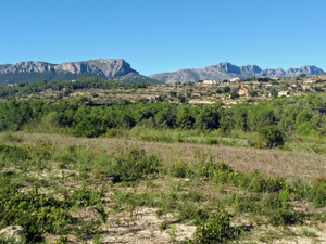
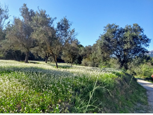
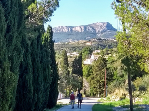
A delightful trail through a tranquil valley, with some woodland paths and varying views of Bernia,Lloma Largo (El Cau ) monte Toix and the Penon Ifach.
Spanish maps included within these descriptions are provided courtesy of the Spanish IGN and remain © Instituto Geográfico Nacional.
OSM (OpenStreetMap) and OCM (OpenCycleMap) maps are © OpenStreetMap Contributors. The OSM project welcomes contributions from all to enrich the map data, which is made freely available. Land (Thunderforest Landscape) maps are © Thunderforest based on data © OpenStreetMap contributors.
The grade of this walk is E/A, which means
E – Easy: A walk of up to 4½ hours on good surfaced tracks and less than 200 metres ascent.
A – All on good tracks
| Nearest town | Benissa |
| Directions to start |
Park on the public car park on the roundabout next to Bar Frau at the N end of the town on the N332. |
| Start point (Lat/Long) | 38.716121, 0.057003 Click here to view in Google Maps (in a new browser tab) |
| Length (km) | 9.30 |
| Ascent (metres) | 170 |
| Walking time (hours) | 2.75 |
| Total time (hours) | 3 |
| Recommendations or Restrictions | None |
Download walk descriptionDownload GPS file
The Mercadona store used as a start point reference has now moved – still on N332, next to Iceland about 300m away. The old store referred to for start point is now a Chinese store.
This walk is as described for SL-CV 136, for which there is a map display board at the top end of the car park above Bar Frau, just before the Mártinez furniture store.
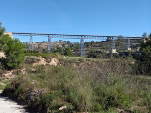
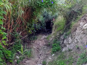
The route description is somewhat vague; “a few metres”, a term used frequently, can mean anything from 10 metres to 300 metres. Look out for green and white marker stripes, of which there are either many or none at critical route-finding points. The narrow path under the viaduct on the return leg was substantially overgrown (1 June 2022) and starts immediately next to a metre-high marker post. Take care in this section, as the path has collapsed just at one point.
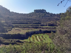
This is a very pleasant walk, although about two thirds of the distance are on metalled roads, despite three stream crossings, two on stepping stones. More arduous than suggested by the ‘Easy’/green designation, with a sustained uphill final third.
Thanks. This route has been designated as a SL since the description was published. Suggestions on how to improve the description – rather than criticism of them – are always welcome as things do change. A “few” would would normally be a small number, so unlikely to stretch to 300, but if we can be more accurate then it would be good to specify if it is possible. Thanks for taking the time to comment.
We did this on 26th Jan 2025 after doing it many years ago with CBMW. There is a problem with this route now as the return section of the green and white marked SL trail is fenced off at +38.694709, +0.053729 just as you approach the two bridges overhead. We climbed the fence as the marker post was still there and found another fence on the other side of the bridges but this has been partly pulled down, I suspect by locals. We continued on a little further and discovered the likely reason for the fencing. The path that continues after the bridge is a very narrow ledge less than 0.5m wide in parts that is 3 to 4 metres above the land below. The ledge sits on what looks like just compacted soil which in parts has broken away leaving very little path behind. We continued along this ledge until it finished but would not do this again and could not recommend it as safe. After rain I could easily see the path giving way under the weight of a walker.
The route authors have checked the route and confirm these points. However they regard the route as safe and it continues to be promoted on the website of the local town hall.