
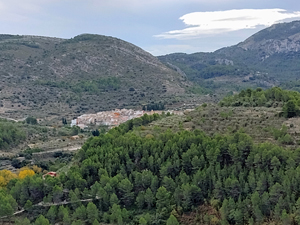
Santa Maira, Serra de L’Alfaro, La Espelda
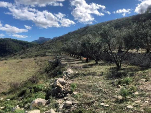
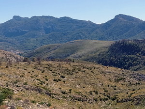
A varied walk with extensive views of the surrounding mountains from a low level ridge, an opportunity for sightings of local wildlife – arrui, wild boar, partridges and others . A large section of the walk on easy forest track with some early easy scrambling.
Spanish maps included within these descriptions are provided courtesy of the Spanish IGN and remain © Instituto Geográfico Nacional.
OSM (OpenStreetMap) and OCM (OpenCycleMap) maps are © OpenStreetMap Contributors. The OSM project welcomes contributions from all to enrich the map data, which is made freely available. Land (Thunderforest Landscape) maps are © Thunderforest based on data © OpenStreetMap contributors.
The grade of this walk is MS/B/Scr, which means
MS – Moderately Strenuous: Up to 600 metres ascent and/or no more than 15 km in length with some rough going taken at a reasonable pace.
B – Less than half the route on rough ground
Scr – Scrambling: This implies the need for handholds to ascend steep rock pitches with a sense of exposure to vertigo and where a slip could lead to a serious accident.
| Nearest town | Castell de Castells |
| Directions to start |
CV720 road, immediately before entering the village of Castell de Castells from direction Benichembla, turn sharp R, downhill past old washhouse, at the bottom by sheep pens and bin compound turn L and park here |
| Start point (Lat/Long) | 38.730916, -0.201783 Click here to view in Google Maps (in a new browser tab) |
| Length (km) | 14.00 |
| Ascent (metres) | 550 |
| Walking time (hours) | 4 |
| Total time (hours) | 5 |
| Recommendations or Restrictions | Minimal early rough section compensated by easy walking on forest track |
Download walk descriptionDownload GPS file
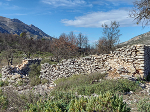
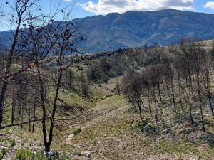
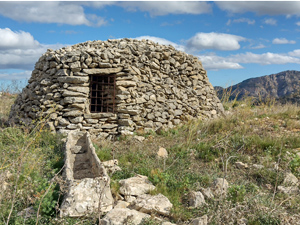
We attempted this walk today but is is pretty near impossible to follow. The path at the start clearly hasn’t been attempted for some time so it’s just a case of scrambling up over the terraces heading in the general direction of the walk. Having successfully got through that bit, there is an indistinct path to follow to a ruined hide but it is very slow going over stones and rocks. No cairns to be seen. After the ruins there is a copse that has had a catastrophic fire at some point and all the charred trees are down completely covering the path making it incredibly hard to get through. After finally getting through the copse the cairns showing the next stretch seem to have been knocked over – possibly by the hunters – so there is no path to follow at all we just had to work our way through a boulder field. We finally got onto the forest track and powered on but took an escape route back to the car. Unless you are feeling very adventurous I would not recommend this walk even though it is beautiful and we saw a large herd of wild mountain sheep twice which was beautiful. It didn’t help that there was a gale force wind which was practically blowing us over.