
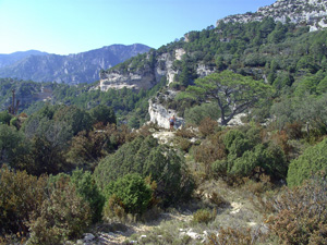
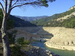
Raco de Tabac
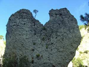
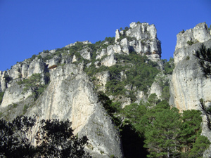
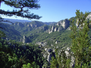
A delightful walk through forest with initially dramatic rock scenery and later fantastic views across the peaks of Els Ports and out to the coast and Ebro delta.
Spanish maps included within these descriptions are provided courtesy of the Spanish IGN and remain © Instituto Geográfico Nacional.
OSM (OpenStreetMap) and OCM (OpenCycleMap) maps are © OpenStreetMap Contributors. The OSM project welcomes contributions from all to enrich the map data, which is made freely available. Land (Thunderforest Landscape) maps are © Thunderforest based on data © OpenStreetMap contributors.
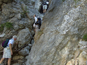
The grade of this walk is VS/B, which means
VS – Very Strenuous: More than 800 metres ascent and/or more than 20km in length with steep, loose or heavily vegetated sections.
B – Less than half the route on rough ground.
| Nearest town | La Senia |
| Directions to start |
CV105 and on towards the Abad and the embalse. Drive up through two tunnels and on past a reservoir wall and continue over a bridge over a second (sometimes dry) reservoir. Once over the bridge turn immediately R on a forest track and continue on a rough track for several km heading for the parking at La Fou. Part way along this there are signs indicating 4 wheel drive only, but most people just keep going! The parking is on the LHS just after passing a small building at the end of a ridge coming down from the L. |
| Start point (Lat/Long) | 40.721344, 0.244805 Click here to view in Google Maps (in a new browser tab) |
| Length (km) | 15.50 |
| Ascent (metres) | 850 |
| Walking time (hours) | 4.25 |
| Total time (hours) | 6.00 |
| Recommendations or Restrictions |
Download walk descriptionDownload GPS file
Comments
Raco de Tabac — No Comments
HTML tags allowed in your comment: <a href="" title=""> <abbr title=""> <acronym title=""> <b> <blockquote cite=""> <cite> <code> <del datetime=""> <em> <i> <q cite=""> <s> <strike> <strong>