
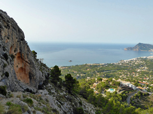
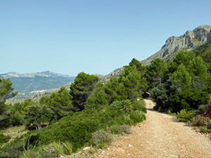
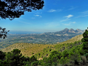
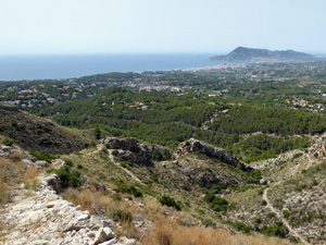
Slopes of the Bernia from Altea la Vella
After a short drive we climb up the Sierra Bernia above Altea Hills, walk along forest paths to the picnic area and drop down a mozarabic path back to Altea la Vella in time for lunch
Spanish maps included within these descriptions are provided courtesy of the Spanish IGN and remain © Instituto Geográfico Nacional.
OSM (OpenStreetMap) and OCM (OpenCycleMap) maps are © OpenStreetMap Contributors. The OSM project welcomes contributions from all to enrich the map data, which is made freely available. Land (Thunderforest Landscape) maps are © Thunderforest based on data © OpenStreetMap contributors.
The grade of this walk is MS/B, which means
MS – Moderately Strenuous: Up to 600 metres ascent and/or no more than 15 km in length with some rough going taken at a reasonable pace.
B – Less than half the route on rough ground
| Nearest town | Altea la Vella |
| Directions to start |
See extensive details at start of walk decription. |
| Start point (Lat/Long) | 38.630624, -0.044456 Click here to view in Google Maps (in a new browser tab) |
| Length (km) | 8.50 |
| Ascent (metres) | 350 |
| Walking time (hours) | 2.66 |
| Total time (hours) | 3.5 |
| Recommendations or Restrictions | The ascents and descents are steep and stoney. |
Download walk descriptionDownload GPS file
Comments
Slopes of the Bernia from Altea la Vella — No Comments
HTML tags allowed in your comment: <a href="" title=""> <abbr title=""> <acronym title=""> <b> <blockquote cite=""> <cite> <code> <del datetime=""> <em> <i> <q cite=""> <s> <strike> <strong>