
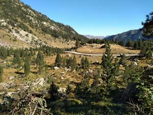
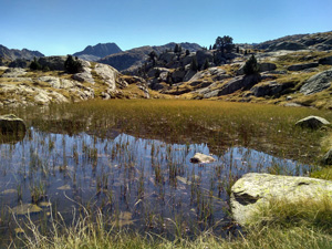
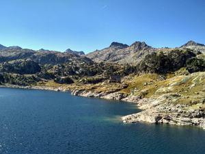
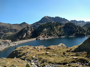
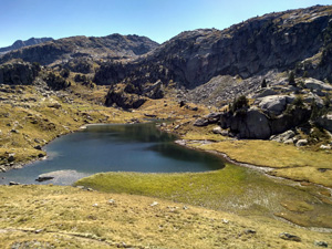
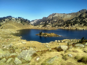
Colomers lakes circuit
A wildly dramatic walk through a never ending set of picture book lakes. Can easily be extended to take in even more. The watershed mountains peer down at you from high above. The refuge is normally open after 2pm for sale of food and drink.
Spanish maps included within these descriptions are provided courtesy of the Spanish IGN and remain © Instituto Geográfico Nacional.
OSM (OpenStreetMap) and OCM (OpenCycleMap) maps are © OpenStreetMap Contributors. The OSM project welcomes contributions from all to enrich the map data, which is made freely available. Land (Thunderforest Landscape) maps are © Thunderforest based on data © OpenStreetMap contributors.
The grade of this walk is MS/C, which means
MS – Moderately Strenuous: Up to 600 metres ascent and/or no more than 15 km in length with some rough going taken at a reasonable pace.
C – More than half the route on rough ground.
| Nearest town | Salardu |
| Directions to start |
From the C28 road in Salardu at a roundabout find a sign pointing to “PN Aigues Tortes” (Park National…………) and take this thin road. Cross over the river and then begin a long twisty route up to a large car park just in front of a small “shed”. The road has been partly resurfaced but there is still a section of potholes and rough going. |
| Start point (Lat/Long) | 42.631795, 0.920620 Click here to view in Google Maps (in a new browser tab) |
| Length (km) | 7.50 |
| Ascent (metres) | 400 |
| Walking time (hours) | 2.5 |
| Total time (hours) | 4.5 |
| Recommendations or Restrictions | None. Needs mountain taxi. (Closed after 15 Sep in 2020) |
Download walk descriptionDownload GPS file
Comments
Colomers lakes circuit — No Comments
HTML tags allowed in your comment: <a href="" title=""> <abbr title=""> <acronym title=""> <b> <blockquote cite=""> <cite> <code> <del datetime=""> <em> <i> <q cite=""> <s> <strike> <strong>