
Tuc de Letassi from Bassa d’Oles
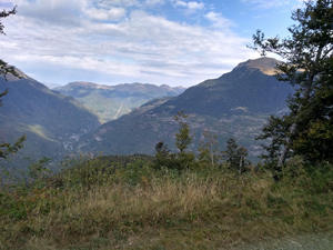
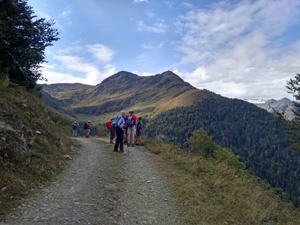
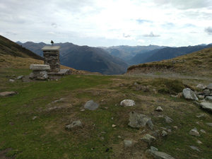
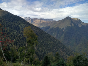
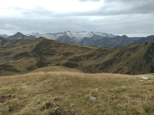
Initially up through easy woodland the route leads out into pasture with wide views and lesser peaks of the Pyrenean chain before reaching a col with access to a grand summit – Tuc de Letassi. (It might be possible to extend the walk along the ridge from here).
Spanish maps included within these descriptions are provided courtesy of the Spanish IGN and remain © Instituto Geográfico Nacional.
OSM (OpenStreetMap) and OCM (OpenCycleMap) maps are © OpenStreetMap Contributors. The OSM project welcomes contributions from all to enrich the map data, which is made freely available. Land (Thunderforest Landscape) maps are © Thunderforest based on data © OpenStreetMap contributors.
The grade of this walk is S/B, which means
S – Strenuous: More than 600 metres ascent and/or more than 15km in length with steep, loose or heavily vegetated sections.
B – Less than half the route on rough ground.
| Nearest town | Gaussac |
| Directions to start |
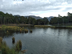
From the middle of Vielha there is a roundabout with the main N-S road – the N230 – and the valley road – the C28 and from here a minor road leads up to Gaussac. Follow this through the village and keep following signs to Bassa d’Oles up through zig-zags to arrive at the lake and field parking. |
| Start point (Lat/Long) | 42.714860, 0.774210 Click here to view in Google Maps (in a new browser tab) |
| Length (km) | 12.50 |
| Ascent (metres) | 750 |
| Walking time (hours) | 3.75 |
| Total time (hours) | 5.5 |
| Recommendations or Restrictions | None |
Download walk descriptionDownload GPS file
Comments
Tuc de Letassi from Bassa d’Oles — No Comments
HTML tags allowed in your comment: <a href="" title=""> <abbr title=""> <acronym title=""> <b> <blockquote cite=""> <cite> <code> <del datetime=""> <em> <i> <q cite=""> <s> <strike> <strong>