
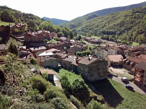
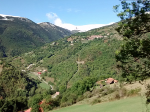
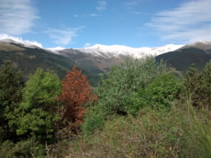
Vilallonga to Setcases
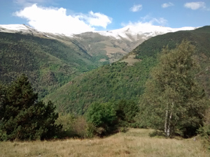
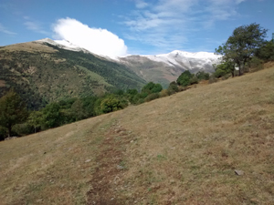
An easy link between the 2 villages with views to the high tops of the Pyrenees in front of you.
Spanish maps included within these descriptions are provided courtesy of the Spanish IGN and remain © Instituto Geográfico Nacional.
OSM (OpenStreetMap) and OCM (OpenCycleMap) maps are © OpenStreetMap Contributors. The OSM project welcomes contributions from all to enrich the map data, which is made freely available. Land (Thunderforest Landscape) maps are © Thunderforest based on data © OpenStreetMap contributors.
The grade of this walk is MS/A, which means
MS – Moderately Strenuous: Up to 600 metres ascent and/or no more than 15 km in length with some rough going taken at a reasonable pace.
A – All on good tracks
| Nearest town | Vilallonga |
| Directions to start |
From the N260 which runs broadly E to W on the S side of the Pyrenees, take the C38 to Camprodon and then the GIV5264 to Vilallonga. |
| Start point (Lat/Long) | 42.331231, 2.312056 Click here to view in Google Maps (in a new browser tab) |
| Length (km) | 7.00 |
| Ascent (metres) | 630 |
| Walking time (hours) | 1.5 |
| Total time (hours) | 2.5 |
| Recommendations or Restrictions | None |
Download walk descriptionDownload GPS file
Comments
Vilallonga to Setcases — No Comments
HTML tags allowed in your comment: <a href="" title=""> <abbr title=""> <acronym title=""> <b> <blockquote cite=""> <cite> <code> <del datetime=""> <em> <i> <q cite=""> <s> <strike> <strong>